The basic need to establish a vehicle's location is important today with emphases on efficiencies in fuel, employee time, employee safety and loss prevention. This requires expanded features in software, including user-defined alarm or message functions. Vehicle operation characteristics can also be tied into AVL (automatic vehicle location) information. In addition, the system allows data downloads to create fleet activity reports.
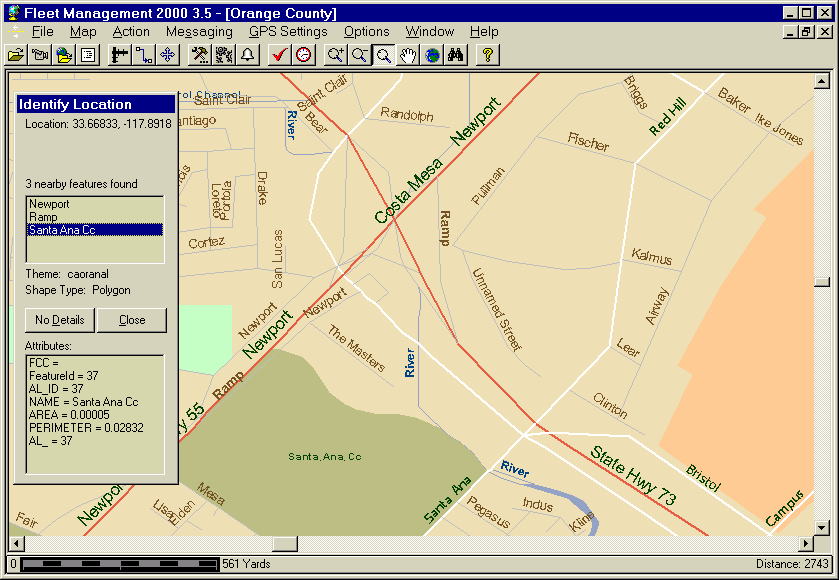
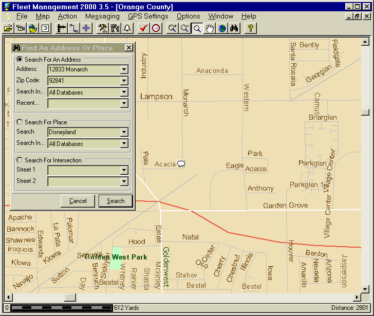
Fleet Management 2000, in large measure, was created to address these needs. It supports vector maps, locates addresses and finds the closest vehicle to a target location. It allows customization of maps with buildings, boundaries and address points, and it can be set to search for street intersections. The software can change the color of displayed vehicle icons to correspond with status messages and activate an alarm when a vehicle is speeding, inactive or stopped. Alarms can also be triggered if a fleet vehicle is out of its assigned territory, or just off-route. Even collisions can be linked back to the alarm system. The system has so many features to match so many customer requests that its Options screen had to be rewritten several times just to deal with the preferences overload.
Out of all the applications I've written, this one has probably received the largest international exposure of all. There is a multitude of reasons, but one of key ones is that in addition to digital vector maps, it supported bitmapped maps. Vector maps are not readily available outside US, thus any one could just scan a paper map, plop down latitude/longitude information and track vehicles in 5 minutes. Another reason, is the low cost of GPS equipment. And yet another, is that Fleet Management 2000 was an excellent application.
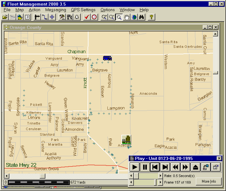
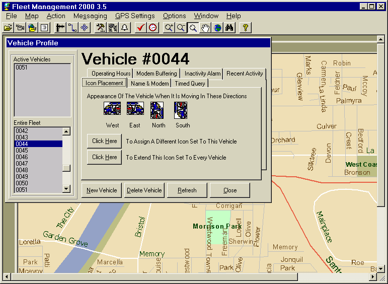
One of the features that customers used over and over again is vehicle movement replay (screenshot below). Among other features were GPS Differential Correction, Management by Exception, Vehicle Boundaries (i.e. generates an alarm if vehicle enters and/or leaves the geographic boundary), Vehicle Routes, Address Search, Place Search, Street Intersection Search, Variable GPS Update Rates, Timed GPS Queries, Modem Buffering (buffering info on the mobile device and sending all the info at once on que) and many others.
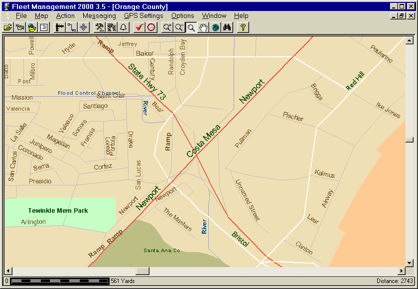
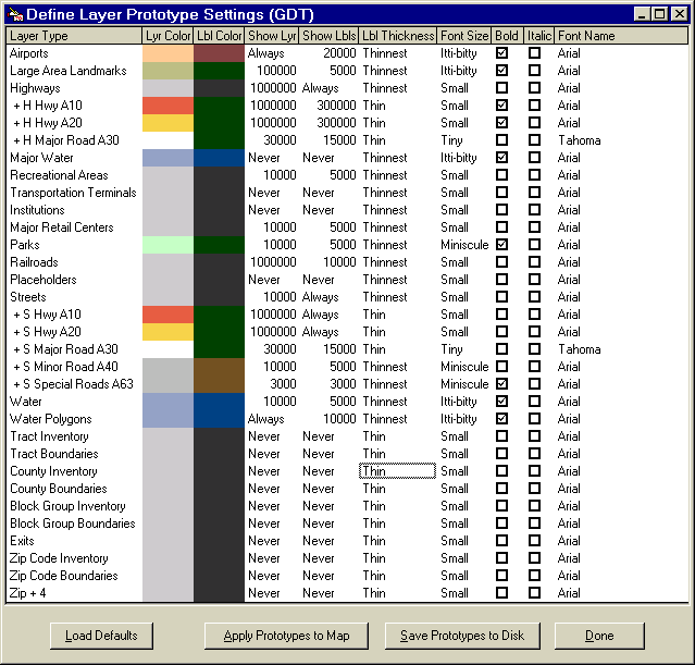
Fleet Management 2000 provided a set of mapping tools that was unmatched at the time. Users could utilize it out of the box or customize it to their particular needs. We've taken the ESRI MapObjects rendering engine as far as it could go to create an extraordinary presentation. Screenshots below provide some idea of the map control.
As a company we got the most mileage out of a 3rd Party Integration feature. We had tons of requests from customers regarding various features that they wanted to see implemented. These features may have been useful to a particular customer, but not useless for the other 99% of users. So I exposed FM2000 via a 3rd Party API - this allowed customers to implement their own features on top of Fleet Management 2000. We supplied a great set of documentation and as a result, all kinds of applications were integrated into Fleet Management (and the other way around). One example of an application to take advantage of Fleet Management 2000 is Dispatch Express.
This project was started in Visual Basic 2. First it used a home grown mapping system utilizing bitmapped maps (there were few digital then). Later on, we switched to digital maps GDT (they now supply maps for Microsoft MapPoint) and ESRI MapObjects for map rendering. On the mobile side we used a variety a Data Express DE-2400 modem with a built-in GPS receiver. As the project grew, it was being ushered through successive versions of Visual Basic, making its stop at version 6. The key challenge was to keep map rendering performance
Unfortunately, as often happened in the dotcom days, the company
was getting bought and sold right and left. Eventually, it lost its
identity and the executives had larger fish to fry.
The pinnacle of the application was a port to a nationwide system of
vehicle tracking. The idea was to open up a nationwide map and see where all
your vehicles were. In addition, one could send text/voice messages via a click.
It is very similar to what Nextel has right now in 2003. Unfortunately, that
was not to be. The last company that owned us imploded under the weight of
its own mismanagement and Fleet Management 2000 pretty much ended its existance.